
Rivers: Erosion, Transport, Deposition & Floods

A river is a conveyor belt that shapes continents. Follow sediment from mountain peak to ocean floor.
Intro GeologyUni Year 1
⏱️ About 18 min
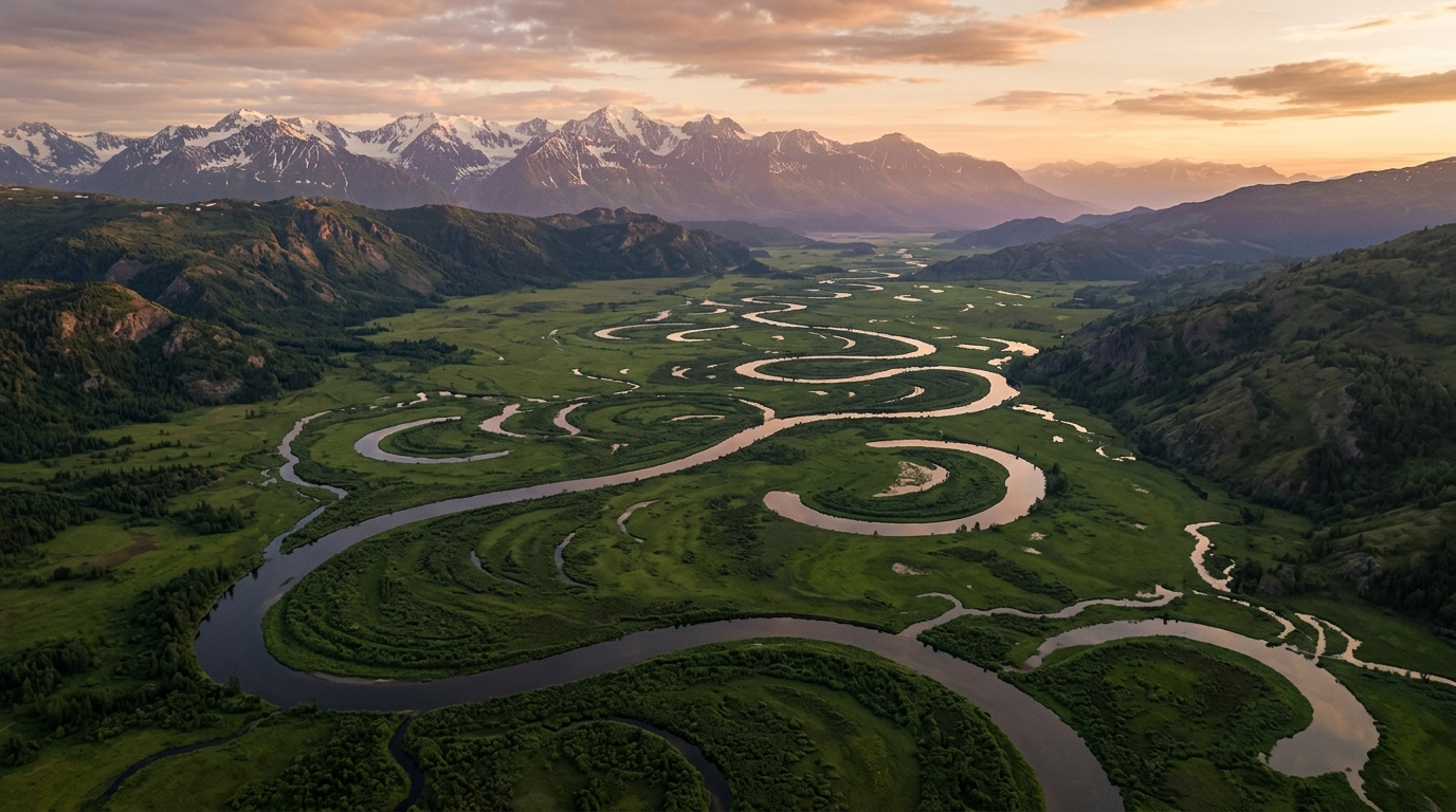
Rivers: Erosion, Transport, Deposition & Floods — illustration
Illustrative image (AI-generated).

The Mississippi River carries an average of 500,000 tonnes of sediment past New Orleans every day — enough to fill a line of dump trucks bumper-to-bumper for hundreds of kilometres. That sediment once sat on a mountainside hundreds of kilometres upstream. Rivers are Earth's longest conveyor belts, and understanding them means understanding how landscapes are built and torn down.

💡
The big idea: Rivers are gradient-driven systems that erode, transport, and deposit sediment along a longitudinal profile from headwaters to mouth. Stream discharge (Q = width × depth × velocity) controls a river's capacity to move sediment. Energy and competence vary along the profile, creating distinct channel patterns — braided, meandering, straight — and landforms such as point bars, cut banks, oxbow lakes, and floodplains.
🎯 By the end, you'll be able to
  • Describe a river's erosion–transport–deposition system and explain how it changes from headwaters to mouth
  • Read a longitudinal profile and relate slope changes to erosion and deposition zones
  • Calculate stream discharge from width, depth, and average velocity
  • Explain how meanders form and evolve, and predict where erosion and deposition occur in a meander bend
📎 Helpful to know first

The river as a system

A river is more than water flowing downhill — it is a system with three linked jobs:

  • Erosion: The river picks up sediment from its bed and banks. Erosion is fastest where the river is steep, fast, and turbulent — typically in the headwaters.
  • Transport: The river carries sediment downstream. The amount it can carry depends on its discharge and velocity.
  • Deposition: When the river slows down — on flatter ground, in lakes, or at the sea — it drops sediment. Deposition builds point bars, deltas, and floodplains.

These three processes are in balance along the river's longitudinal profile — a graph of river elevation versus distance downstream. Headwaters are steep; the gradient gradually flattens toward the mouth.

Discharge: how much water moves through

Discharge (Q) is the volume of water passing a cross-section per unit time. It is calculated from the channel's cross-sectional area and the average flow velocity:

\[ Q = w \times d \times \bar{v} \]
Stream discharge Q (m³/s) = channel width w (m) × average depth d (m) × average velocity v̄ (m/s). This is the single most useful number for predicting a river's sediment-transport power.
📝 Worked example: A river channel is 12 m wide and 1.5 m deep on average. The water flows at 0.8 m/s. What is the discharge?
  1. Q = w × d × v̄
  2. Q = 12 m × 1.5 m × 0.8 m/s
  3. Q = 14.4 m³/s
✓ The discharge is 14.4 cubic metres per second (about 14,400 litres per second).
✏️ Practice: A stream is 8 m wide, 0.6 m deep, and flows at 1.2 m/s. Calculate the discharge in m³/s.
m³/s
Solution
  1. Q = w × d × v̄
  2. Q = 8 × 0.6 × 1.2
  3. Q = 5.76 m³/s.
✏️ Practice: If a river's discharge is 25 m³/s, its width is 10 m, and its average depth is 2 m, what is the average velocity?
m/s
Solution
  1. Rearrange Q = w × d × v̄ to solve for v̄: v̄ = Q ÷ (w × d)
  2. v̄ = 25 ÷ (10 × 2)
  3. v̄ = 25 ÷ 20 = 1.25 m/s.

Meanders: the river's winding path

On gentle gradients with erodible, cohesive banks, rivers often form meanders — sinuous curves. The physics is simple:

  • Water moves fastest around the outside of a bend, where it erodes a cut bank.
  • Water slows on the inside of the bend, depositing a point bar.

Over time, the meander grows more exaggerated. Eventually two bends may meet, and the river cuts through the narrow neck, leaving an oxbow lake behind as a curved, isolated body of water.

🎮 Meandering-River Evolution LIVE
Predict first: Adjust discharge, slope, and bank erodibility to see how channel pattern changes.

Interactive simulation showing a meandering river evolving over time, with cut banks eroding and point bars building.

Watch a river migrate: erosion on the outside of bends, deposition on the inside, and eventual cutoff forming an oxbow lake.
🔑 Meanders need the right banks
Meanders develop where banks are erodible and cohesive — typically silt and clay that hold together but can still be worn away. On resistant bedrock or in non-cohesive gravel, the river tends to stay straight or braided rather than meandering. Discharge and slope alone do not guarantee meanders; bank material matters.
Meander evolution from bend growth to neck cutoff and oxbow lake formation 1. Growing meander river cut bank point bar 2. Neck narrows river neck 3. Cutoff → oxbow lake new channel oxbow lake Meander evolution and oxbow-lake formation

Sequence showing a meander bend growing, the neck narrowing, the river cutting through during a flood, and the abandoned bend becoming an oxbow lake.

Meander evolution: erosion on the outside of bends, deposition on the inside, neck cutoff, and oxbow-lake formation.

Floods and floodplains

When discharge exceeds the channel's capacity, water spills onto the adjacent land — a flood. Repeated flooding deposits layers of sediment, building a floodplain — a flat, fertile strip of land bordering the river. Floodplain sediments are typically fine-grained (sand, silt, clay) because floodwaters slow as they leave the channel, dropping their load.

Levees (natural ridges of deposited sediment) build up along the channel banks during floods. Human-made levees try to confine the river, but they can increase downstream flood risk by preventing water from spreading onto the floodplain.

Check your understanding

1. In a meander bend, where does erosion occur?
Water velocity is highest on the outside of a bend, scouring the cut bank. The inside of the bend has slower water that deposits a point bar.
2. A river channel is 15 m wide, 2 m deep, and flows at 0.5 m/s. What is the discharge?
Q = w × d × v̄ = 15 × 2 × 0.5 = 15 m³/s.
3. What happens when a river's meander neck is cut through?
When a river cuts through the narrow neck between two bends, the old curved channel is abandoned and becomes an oxbow lake — a crescent-shaped body of water isolated from the main channel.
✅ Key takeaways
  • Rivers erode, transport, and deposit sediment along a gradient-driven longitudinal profile from steep headwaters to flat mouths.
  • Stream discharge Q = w × d × v̄ predicts how much water and sediment a river can move.
  • Meanders form on gentle slopes with erodible, cohesive banks: erosion on the outside (cut bank), deposition on the inside (point bar).
  • Oxbow lakes form when a meander neck is cut through, abandoning the curved channel.
  • Floods build floodplains by depositing fine sediment beyond the channel banks.
➡️ Rivers are the most visible part of the water cycle at Earth's surface, but much of the freshwater we depend on — and much of the water that feeds rivers — travels underground through pores and fractures. That subsurface world of groundwater is the next stop.
Want to test yourself on this? Try the Science practice tests →
🎓 Go deeper: university courses & trusted references

Handpicked external material for this module — for when you want the full university treatment of surface processes.

External sites are listed for reference only. This course is independent and has no affiliation with, or endorsement from, the institutions named.